This is the 2nd part of how to get the necessary permissions to fly a camera drone legally in Portugal specifically Lisbon and Sintra.
Read Part 1 here so you can get to this step before proceeding.
Read Part 3 here concluding the process.
At this point you should have an E-AAN account, which has been approved. As well as the details of your drone and the people who will pilot it entered in the relevant sections of your E-AAN account.
After logging in to your E-AAN account, click on the Areas tab then click on Add.
Decide if you will fly over the Sea or Beach. Then start by selecting District then the County, after which the page will update. Now using the drop down menus select the drone and pilot who will be flying.
Set the date period you want to fly for this application, and then select time period – you should just set this to ‘From sunrise to sunset’.
Next choose the type of area – for this I would suggest picking polygonal, as this will give you the most freedom to describe the area of flying. You can also choose circular or define an actual route.
Page should update and you can now enter the maximum height of the flight, and then click on the choose button in the next box – this will bring up a map dialog where you can enter the points (hint: pick up the red drop and move it around).
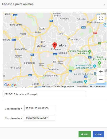
Click on Add once you are at the correct point, then move the red drop to next point of your polygon shape. Keep adding points till your area is defined. Sadly the map dialog does not show your progress, so you are working blind. Might be worth doing this in a separate map program, so you have a clear idea where the points should go!
If you choose circular route, then you can just set a radius around the point selected on the map.
Do not forget to set the maximum flight altitude – in my case I left it at 50m.
Finally, choose what you are doing with your drone – in my case photography and filming. Enter the reasons for it and if it is on behalf of a 3rd party (recipient entity). Explain where the resulting imagery will go and if it will be shared with anyone else e.g. YouTube, etc…
My finished form looked like this.
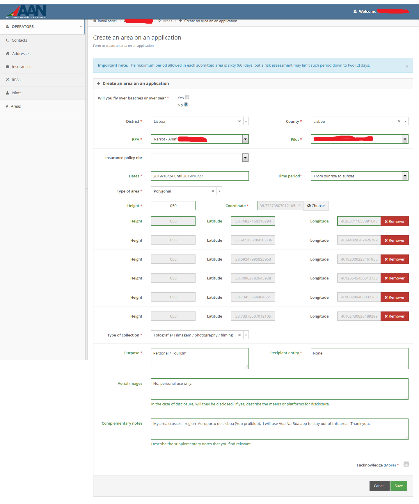
In the observation/comments, I noted that some of my polygon crossed over the Lisbon airport red zone – just to let them know I was aware of it and I would be using their app to make sure I did not enter it.
Check the form over and click save to submit the application.
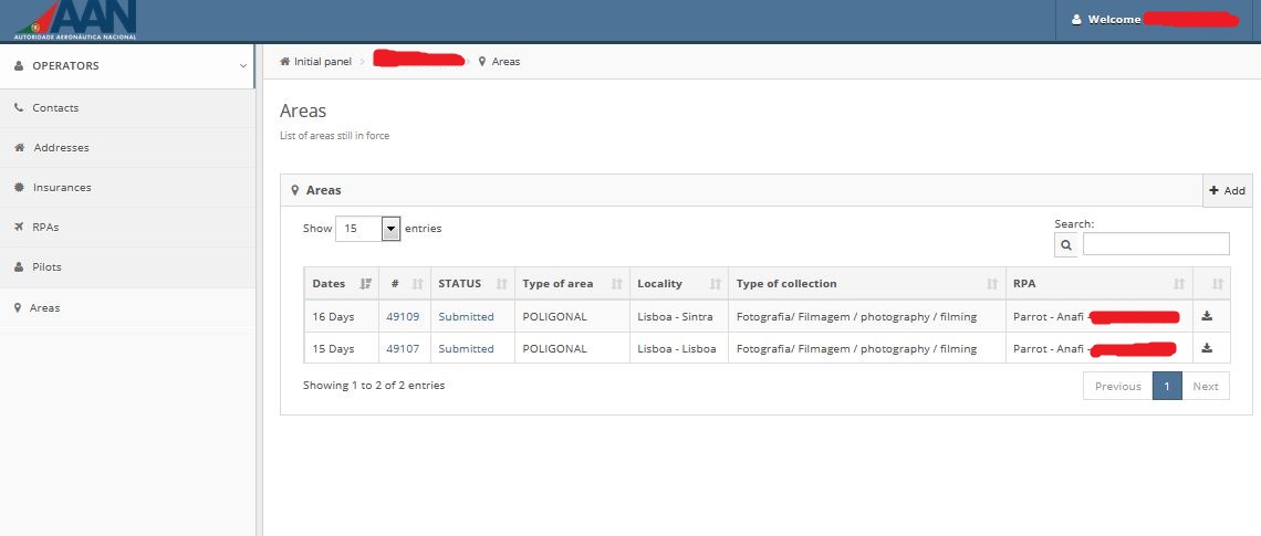
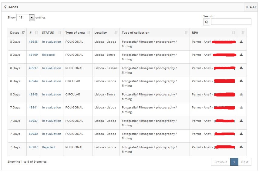
After you have added the areas you want to fly, the Areas tab will look like this – showing the area applications as well as their status. You will also get email receipts for the submitted applications.
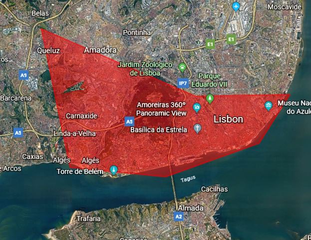
You can download Google Earth KML files of the application, which you can then import in to Google Earth, or better yet Google Earth Web version, so you can check that the areas you submitted are correct.
Now sit back and wait!!!
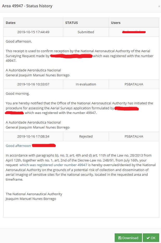
Well after around 7 days I got an email saying that my application is being processed and sadly a few minutes later an email stating that my application had been rejected!!

So feeling pretty disheartened, the rejections did have a note to me – they advised that they are more likely to give permission for smaller areas especially in military airspace (all of Sintra is military airspace!).
With a smidge of good news, I went away and looked at my travel itinerary and areas I was most likely to visit – I created new applications with much smaller areas centred around the main points of interest for me. In total I created another 7 areas.
More waiting!!!!
Very next day, I got my application processing emails for all the new areas I had submitted, so less than 16 hours wait for them to be looked at and after another few hours – the emails started coming in. So this time the applications were processed in around 24 hours. Cool!!
Sadly all my applications for greater Lisbon area got rejected – due to sensitive and national security reasons. However 2 of my Sintra areas where approved (‘deferred’) and 1 area was referred to the Portuguese Air Force for advice.
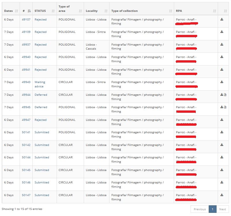
Not to be deterred I submitted another 6 applications with tiny circular routes of around 250m radius around the tourist sites that I would be visiting.
I think they must have got fed up with me and my applications, as the 6 small circular areas I submitted where processed within minutes of submitting – and finally I got some permissions for flying in greater Lisbon. Good news!!

I requested flying permission for the 4 days I was visiting, but one of the areas they could only give me permission for 2 day period – so I replied via email with the 2 days which worked for me.
Go to Part 3 where we will finalise and conclude this process.